
By Gian Andre Corpuz, MIFFT2026
One month and two weeks into my Master’s in Finance at London Business School, I never imagined I’d already be taking the first steps in building a research project. Yet here we are.
The idea started as something small for my personal portfolio of machine learning projects, maybe an experiment with Natural Language Processing (NLP). Then I met someone who wanted to tackle a real computer vision (CV) problem. I jumped at the chance, even with no CV background, because I wanted to learn and push myself.
From there it grew. We discussed, I read literature, I sought advice from data science friends, and we iterated again and again. The project began to take shape: using satellite imagery of flood damage to understand how disasters affect economic and financial health, with the goal of publishing.
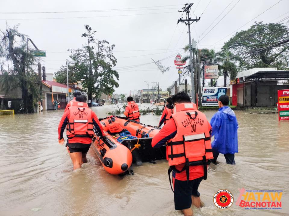
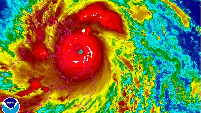
The inspiration deepened with recent events back home in the Philippines. Typhoon Ragasa, Typhoon Tapah, and Tropical Storm Mitag brought devastating floods in recent weeks, followed by protests over corruption and the mismanagement of flood-control projects.
We’ve been fortunate to receive guidance from faculty at LBS. Just one 45-minute conversation left me with a wealth of knowledge on how research is shaped at a top school by professors with decades of experience. The conversation challenged us to anchor the project in energy markets and to think carefully about counterfactuals. What would happen without the satellite imagery? A baseline model built only from delayed news reports is noisy and biased, while a model enriched with satellite data might anticipate impacts more accurately and earlier.
We also discussed framing disasters as causal shocks to electricity demand and prices, testing how typhoons ripple through power markets, and even exploring how rooftop solar detection could improve demand forecasts. The big takeaway was clear: research is about constructing valid comparisons, measuring accuracy rigorously, and scoping the research so the results hold up under scrutiny – not just making models.
From Vision to Research Outline
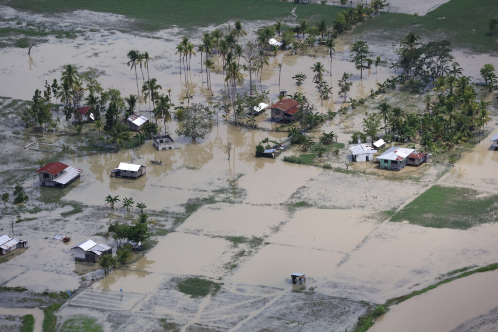
To make this concrete, we’ve sketched an outline that anchors the project. Natural disasters increasingly disrupt electricity systems, creating shocks to demand, prices, and grid reliability. Recent typhoons in Japan and the Philippines show how flooding and infrastructure damage translate into measurable market and welfare impacts. Yet today’s forecasting tools rely heavily on delayed reports and analyst estimates, which means responses often lag behind reality on the ground.
Our research question is simple to state but ambitious to answer:
Can satellite imagery improve how we anticipate disaster-driven shocks to electricity demand and wholesale prices?
To explore this, we plan to:
- Construct disaster indices from satellite imagery (SAR flood maps, VIIRS night lights).
- Build baseline counterfactual models of demand and prices without satellite data.
- Incorporate satellite-derived signals into forecasting and compare accuracy and timeliness.
The benefits extend beyond academia:
- Energy operators: more reliable demand forecasts, less volatility during disasters.
- Policymakers/regulators: evidence for resilience planning and infrastructure investment.
- Investors/insurers: better pricing of climate-related risks.
- Public: greater supply reliability and lower costs from poor forecasting.
Academically, the project offers a novel integration of satellite data into energy economics. Practically, it could provide a framework that outperforms traditional analyst- or news-based models. And for policy, it points to disaster resilience insights that apply across emerging and advanced markets alike.
The Long Horizon of Research
I’d be lying if I said I wasn’t both anxious and excited. Excited because it’s something new, a great undertaking that might one day lead to a paper under my name, and because I’ll be working with smart and ambitious people. Anxious because I know the journey ahead is long. Months of literature review, data gathering, refining methodology, revising analysis, and editing drafts again and again. This is not a one-and-done thing. But then, nothing worth doing ever is.
Faculty also reminded us of the timelines involved: serious papers take several months at minimum, and top-journal work can stretch into years. In fact, when I asked if our project was “PhD-level,” the answer was yes, and the point was made that some PhD students even graduate without a fully published paper. The takeaway was sobering but motivating: if our work ends up publishable, then it’s already at the standard of PhD research.
That means being realistic about the timeline and expectations. The path forward looks something like this:
- Phase 1: Collect and process satellite and energy data, build disaster shock indices.
- Phase 2: Develop baseline counterfactual models without satellite data.
- Phase 3: Add satellite-derived indices and test whether they improve accuracy and timeliness.
- Phase 4: Draft working paper, submit to conferences, and eventually push toward journal publication.
Each phase brings its own challenges – technical, analytical, and organizational – but each also builds toward something bigger than the sum of its parts.
That’s why it’s critical for us, and for the teammates joining soon, to align on motivations. Everyone will bring their own goals, whether academic credit, technical growth, or professional impact. We’ll need to be honest about what each of us wants to get out of this and how much time we can realistically commit.
The LBS Community
In parallel, I’ve been reaching out to build the team. The amount and variety of experience among those who expressed interest has been humbling. Applicants include a PhD in Finance with a computer science background, an FX trader at BlackRock with a decade of Python experience, former ML engineers and data architects, remote sensing specialists, and peers with deep strategy and storytelling expertise.
And the list keeps growing. Recent applicants range from an aerospace engineer-turned-analyst with experience pitching investments across industries, to an MBA with flood modelling expertise from AECOM and the World Bank, to a MiM whose dream has always been to co-author a research paper. Others bring energy sector experience, years in asset management technology, or expertise in geospatial sensing systems. One applicant wrote that the project resonated deeply because, as a Filipino, he had lived through the disruptions disasters bring to communities and economies.
It is exactly what you’d expect at a world-class institution like LBS. People from every background imaginable. It will be an honour to work with whichever team we ultimately form, even though I sadly cannot bring everyone in.
Looking Ahead
This is only the beginning, but I’m excited to see where this journey leads and how it might improve the way we understand and respond to disasters. The road will be long, and that’s part of the point.
If you’re an LBS student, I hope this post inspires you to consider your own project. There is no better time. We’re surrounded by brilliant and driven peers, each with their own strengths. Take advantage of that energy in your own way through innovative research, building ventures, or driving social impact projects.
And if you’re working at the intersection of data, energy, and disaster resilience, I would be glad to connect and learn from your perspective. For us, the immediate next step is finalizing the core team, narrowing the research questions, and laying the groundwork for a first working paper.